Putnam Farm Educational Walk Recap (3-5-2014)
On Saturday, April 5th, 2014, Kris Ramsay, Director of the Orleans Conservation Trust (OCT), led a group of hikers on a short 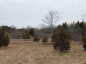 walk through the Putnam Farm Conservation Area off Bridge Road in Orleans.
The Putnam Farm Conservation Area contains 14 acres of land and was purchased by the Town in December of 2010 for $360,000, a little more than half of which came from the State after the Town was successfully awarded a Land Acquisition for Natural Diversity (LAND) grant. Today the property is under the care and control of the Conservation Commission and is to only be used for conservation, agriculture, and passive recreation purposes.
Early in the walk Kris led the group to a small opening in the vegetation that looked out over the southeastern corner of Boat Meadow marsh, which divides Orleans from Eastham. Today it doesn’t look like much more than a kayak could snake through the small creek; however, Kris noted that this small creek is referred to as Jeremiah’s Gutter and has a very unique history. In fact, Jeremiah’s Gutter was the first canal to cut across the peninsula of Cape Cod, connecting Cape Cod Bay in the west to the Atlantic Ocean in the east.
Kris went on to explain that during the spring of 1717, the 1.5-mile passage between Boat Meadow Creek and Town Cove was  deepened. The canal was very shallow and allowed for a maximum of twenty-ton boats when the tides were just right. It is reported that use of the canal could shorten a trip by as much as a day, with a ship cutting through the Cape instead of traveling around the arm of the Cape. In 1804, the canal was widened and improved, which allowed for use during the War of 1812. Eventually, proposals for a new canal began to take priority in the late 1800s (although the construction of the railroad, today’s bike trail, around that time might have permanently blocked passage, and the canal began to fall into disrepair). In 1916, the opening of the Cape Cod Canal created a permanent canal for the Cape and Jeremiah’s Gutter was no longer a priority. Today any trace of the canal from the eastern end near Town Cove has been removed by the construction of Route 6 and/or by the construction of homes and stores.
As the group continued along the edges of the open fields, Kris discussed how Putnam Farm has been used for agricultural purpose for centuries. In fact, Kris noted that when the Town purchased the land from the Putnams there were still greenhouses on site, water lines, and other equipment and debris associated with farming. On a side note, Kris pointed out that in 1957 the Putnams rolled back the topsoil and sold the gravel under the topsoil to the MA Department of Public Works to use as the fill required to construct the Eastham rotary. After the removal of the gravel fill, the topsoil was pushed back onto the site and the Putnam family began to reuse the site for agricultural purposes. The farm’s original elevation is very evident along the property boundaries, fluctuating as much as ten feet in some locations.
Within the interior of the property, the group came across two small freshwater wetlands. While man-made, again for agricultural  purposes, these wetlands are acting as an important watering hole for local wildlife, including migrating birds, and could possibly host important amphibians, such as the spade foot toad or wood frog.
Lastly, Kris described a number of the unique tree species that can be found on site, including the English Oak. The English Oak, as its name implies, is an oak tree native to England (or more accurately Europe, northern Africa, and western Asia), and therefore is not a tree native to the Cape. The English Oak has leaves that are alternate with lobes that vary in terms of their size and depth. The leaf shape is most easily confused with those of the White Oak, but when compared to the White Oak leaf, the leaves of the English Oak are much typically smaller in length and width, no matter the age of the tree.
If you missed the walk and want the chance to see some of our local wildlife, join us for our next walk at the White’s Lane Conservation Area on Saturday, April 19th, 2014 from 9:00 – 10:00am. Bob Prescott, Executive Director of MA Audubon Wellfleet Bay and an OCT Trustee will be leading the walk.
Directions: From the intersection of Rt. 28 and Main Street in Orleans head east towards Nauset Beach for .4 miles. Take the 3rd right onto Monument Road and follow for .4 miles. Take a left onto Henson Way (dirt road) and follow until the end. Parking will be straight ahead.


