Kenrick Woods Conservation Area

Acres: 46
Total Trail Length: 1 mile
Parking: 35 Namequoit Road, Orleans
Conservation History and Importance:
Between 2002 and 2007, the Town of Orleans acquired three contiguous parcels totaling 46 acres of woodland between John Kenrick Road, Route 28, and Namequoit Road for conservation and recreation purposes. These parcels are collectively known as the John Kenrick Woods Conservation Area. This conservation area is an integral part of an extensive greenbelt on the lower Cape covering over 600 acres. It is part of the watershed contributing to Areys Pond, which connects to Pleasant Bay. The original South Orleans General Store was located on the Kenrick farmstead.
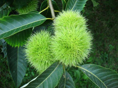
This parcel is best described as a White Pine-Oak Forest with a dominance of white pine. The tall, straight lumber from Kenrick Woods was coveted for flagpoles as well as spars and planks for sailing vessels of the1800s. Interestingly, more than 75 American chestnuts can also be found on site. According to the American Chestnut Foundation, this is the only location in the state where chestnuts are reproducing.
Trailhead Parking:
Directions: From the intersection of Rt. 28 and Main Street Orleans head south on Rt. 28 towards Chatham (1.7 miles). Take a left onto Namequoit Road and follow for .3 miles to trail head on right.